Gombe StateのOBJ形式マップ
OpenStreetMap データから作成された地図、ダウンロード可能
地図をカスタマイズ
この場所のエリアをコンストラクターで開き、目的に合わせてすべてを調整できます
コンストラクターで開く →地図パスポート
OBJについて
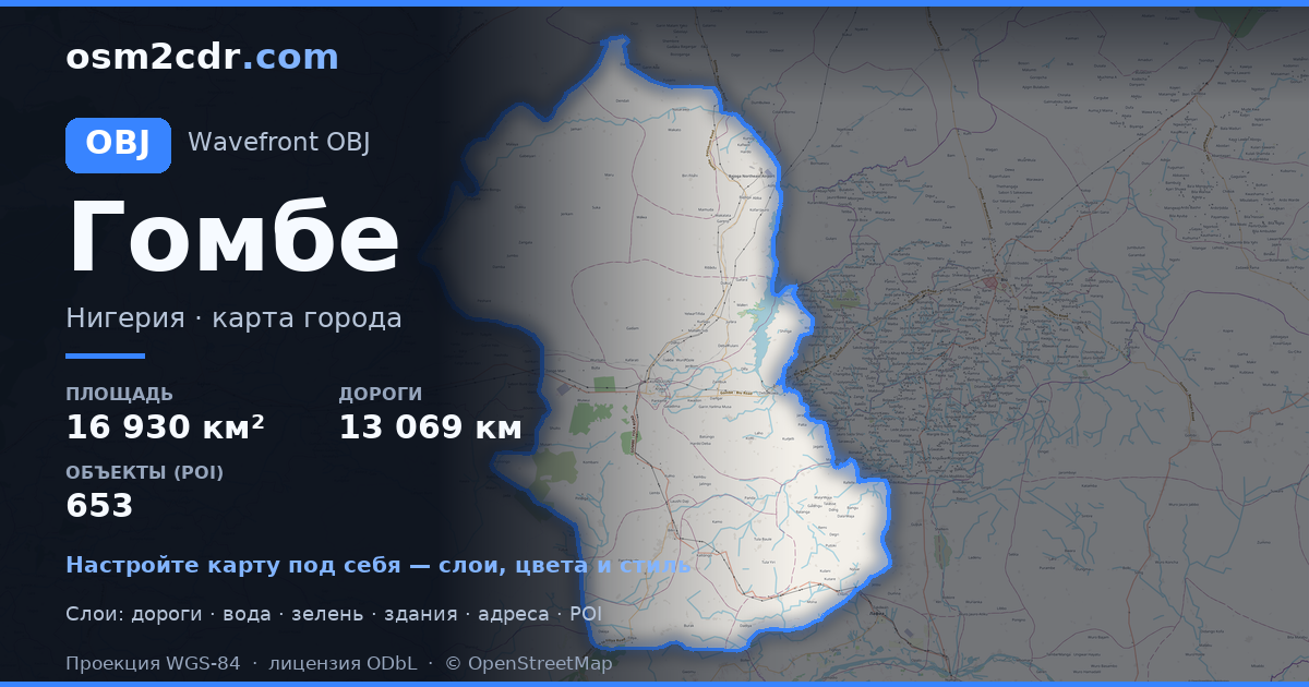
Gombe State の地図を OBJ 形式で — 選択したエリアの実際の OpenStreetMap データのエクスポートです。
Wavefront OBJ is a universal 3D model format with material support. Buildings are exported with texture coordinates and groups by type.
ファイルに含まれるレイヤー
選択したエリアのこのファイルには次が含まれます:
- 道路
- 建物
- 水域
- 緑地
- ポイント・オブ・インタレスト
座標系
WGS 84(EPSG:4326)、ウィザードで選択可能
互換性
単位
メートル(選択した座標系での投影)
| カテゴリ | 3D |
| ファイル拡張子 | .obj |
| レベル | Free |
What's in the OBJ map of Gombe State
308,574 buildings (345 residential, 58 commercial, 3 industrial, 4 religious), 13,069.3 km of roads, 653 points of interest, 15 landmarks.
Mostly unclassified roads 7,016.3 km, residential streets 3,749.6 km, tertiary roads 965.2 km.
1.5% of the area is green space.
Key amenities: colleges — 18, schools — 75, libraries — 8.
3D scene with 308,574 buildings for Blender, Cinema 4D, and other 3D editors.
Main streets: Gombe - Potiskum Road, Mutum Daya to Filiya Road, Gombe - Biu Road, Gombe - Potiskum Road; Ashaka Bajago Road, TUMU KASHERE ROAD
Landmarks: Zoological park, Emir Palace Tangale, District Head Kalmai, WELCOME TO GOMBE CENTRAL GATE, Field 2
Gombe State で OBJ を使う方法
- メインページで Gombe State の地図エリアを選択します
- OBJ 形式を選んでエクスポート設定を調整します
- 「エクスポート」をクリックして処理が完了するのを待ちます
- 完成したファイルをダウンロードして目的のプログラムで使用します


