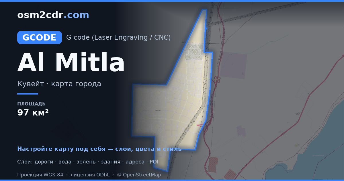
Al MitlaのG-code形式マップ
OpenStreetMap データから作成された地図、ダウンロード可能
地図をカスタマイズ
この場所のエリアをコンストラクターで開き、目的に合わせてすべてを調整できます
コンストラクターで開く →地図パスポート
面積97 km²
建物1
道路1 243 km
ポイント・オブ・インタレスト91
G-codeについて
Al Mitla の地図を G-code 形式で — 選択したエリアの実際の OpenStreetMap データのエクスポートです。
G-code is a CNC and laser engraver control language. Maps are converted to toolpaths for laser cutting or engraving.
ファイルに含まれるレイヤー
選択したエリアのこのファイルには次が含まれます:
- 道路
- 建物
- ポイント・オブ・インタレスト
座標系
WGS 84(EPSG:4326)、ウィザードで選択可能
互換性
LightBurnLaserGRBLFusion 360Inkscape (gcodetools)UGS
単位
メートル(選択した座標系での投影)
| カテゴリ | GIS |
| ファイル拡張子 | .gcode |
| レベル | 無料 |
What's in the G-code map of Al Mitla
1 buildings (1 residential), 1,242.6 km of roads, 91 points of interest, 30 landmarks.
The area covers 97 km², with about 0 buildings per km².
Mostly residential streets 871.5 km, tertiary roads 225.1 km, service roads 101.6 km.
Key amenities: department stores — 1, police stations — 18, viewpoints — 64.
Main streets: شارع ابو حنيفة, شارع 304
Landmarks: p20, P.21, 103. 757, P10, 103.821
Al Mitla で G-code を使う方法
- メインページで Al Mitla の地図エリアを選択します
- G-code 形式を選んでエクスポート設定を調整します
- 「エクスポート」をクリックして処理が完了するのを待ちます
- 完成したファイルをダウンロードして目的のプログラムで使用します
G-code を開けるプログラム
LightBurnLaserGRBLFusion 360Inkscape (gcodetools)UGS


