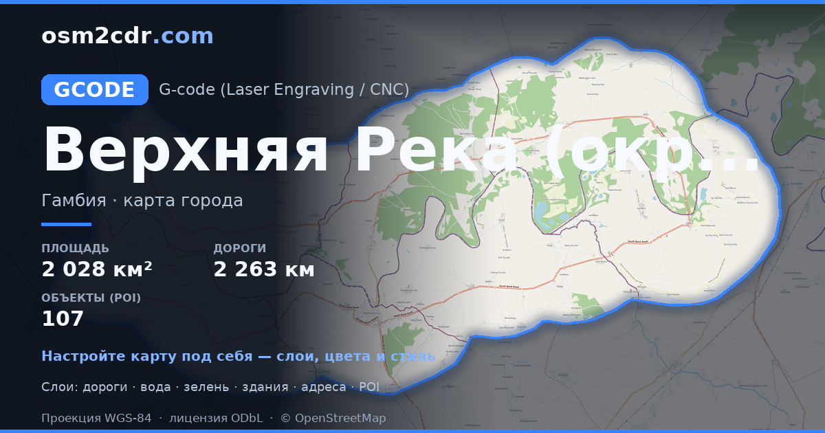
Upper River DivisionのG-code形式マップ
OpenStreetMap データから作成された地図、ダウンロード可能
地図をカスタマイズ
この場所のエリアをコンストラクターで開き、目的に合わせてすべてを調整できます
コンストラクターで開く →地図パスポート
G-codeについて
Upper River Division の地図を G-code 形式で — 選択したエリアの実際の OpenStreetMap データのエクスポートです。
G-code is a CNC and laser engraver control language. Maps are converted to toolpaths for laser cutting or engraving.
ファイルに含まれるレイヤー
選択したエリアのこのファイルには次が含まれます:
- 道路
- 建物
- 水域
- 緑地
- ポイント・オブ・インタレスト
座標系
WGS 84(EPSG:4326)、ウィザードで選択可能
互換性
単位
メートル(選択した座標系での投影)
| カテゴリ | GIS |
| ファイル拡張子 | .gcode |
| レベル | Free |
What's in the G-code map of Upper River Division
36,519 buildings (28,229 residential, 1 commercial, 8 industrial, 5 religious), 2,263.4 km of roads, 107 points of interest, 11 landmarks.
Mostly unclassified roads 1,406.5 km, residential streets 432.6 km, trunk roads 188.1 km.
23.1% of the area is green space.
Key amenities: schools — 10, hospitals — 3, clinics — 3.
Main streets: fatoto to kantali kunda high way, Garawol Road, Badari - Kulari Highway, South Bank Road, Yusubi Sarr Street
Landmarks: Fatty Fin Burial Place, Video Club, Sutukoba Mosque, New Mosque, koina central mosque
Upper River Division で G-code を使う方法
- メインページで Upper River Division の地図エリアを選択します
- G-code 形式を選んでエクスポート設定を調整します
- 「エクスポート」をクリックして処理が完了するのを待ちます
- 完成したファイルをダウンロードして目的のプログラムで使用します


