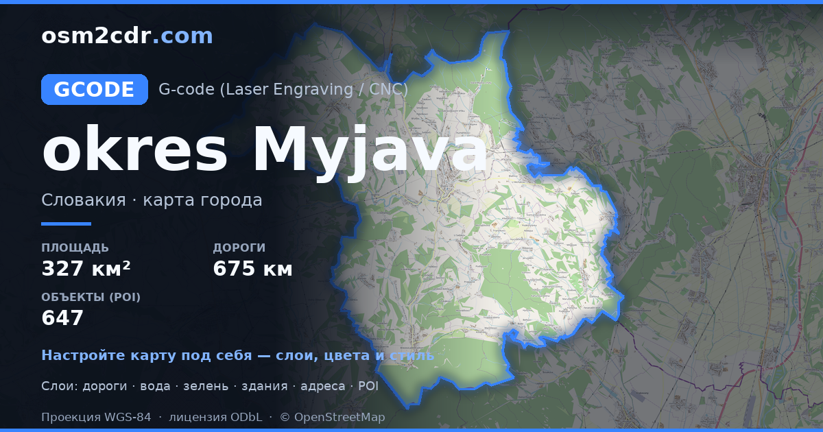
District of MyjavaのG-code形式マップ
OpenStreetMap データから作成された地図、ダウンロード可能
地図をカスタマイズ
この場所のエリアをコンストラクターで開き、目的に合わせてすべてを調整できます
コンストラクターで開く →地図パスポート
G-codeについて
District of Myjava の地図を G-code 形式で — 選択したエリアの実際の OpenStreetMap データのエクスポートです。
G-code is a CNC and laser engraver control language. Maps are converted to toolpaths for laser cutting or engraving.
ファイルに含まれるレイヤー
選択したエリアのこのファイルには次が含まれます:
- 道路
- 建物
- 水域
- 緑地
- ポイント・オブ・インタレスト
座標系
WGS 84(EPSG:4326)、ウィザードで選択可能
互換性
単位
メートル(選択した座標系での投影)
| カテゴリ | GIS |
| ファイル拡張子 | .gcode |
| レベル | 無料 |
What's in the G-code map of District of Myjava
18,697 buildings (411 residential, 27 commercial, 1 industrial, 15 religious), 675.3 km of roads, 647 points of interest, 30 landmarks.
The area covers 327 km², with about 57 buildings per km².
Mostly service roads 217.4 km, tertiary roads 182.3 km, residential streets 143.9 km.
53.2% of the area is green space.
The map marks 40 water bodies.
Key amenities: schools — 13, libraries — 10, supermarkets — 10.
Public transport: 205 bus stops, 6 tram stops, 7 rail stations.
Main streets: Žriedlová dolina, Jablonská, Staromyjavská, Moravská, Minárčiných
Landmarks: Múzeum Dušana Samuela Jurkoviča v Brezovej pod Bradlom, Múzeum Milana Rastislava Štefánika, Vrbovčianska izba, Múzeum SNR, Partizánske bunkre Zemľanky
District of Myjava で G-code を使う方法
- メインページで District of Myjava の地図エリアを選択します
- G-code 形式を選んでエクスポート設定を調整します
- 「エクスポート」をクリックして処理が完了するのを待ちます
- 完成したファイルをダウンロードして目的のプログラムで使用します


