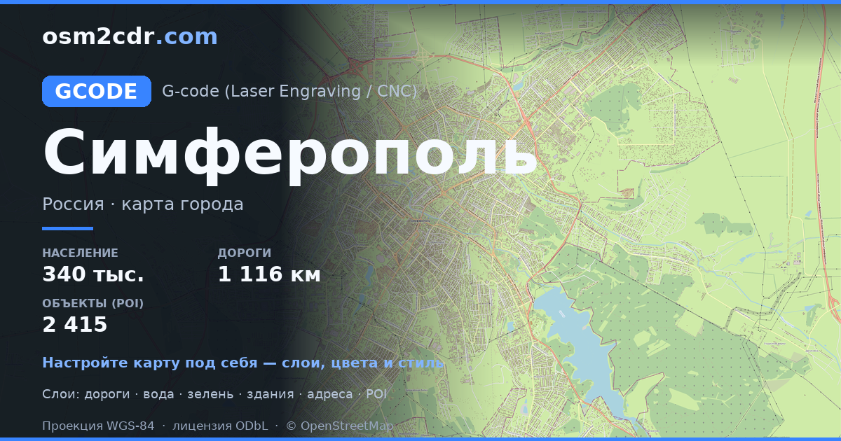
Map of Simferopol in G-code format
Peta yang dibangun dari data OpenStreetMap, siap diunduh
Sesuaikan peta untuk Anda
Buka area tempat ini di konstruktor dan sesuaikan semuanya dengan kebutuhan Anda
Buka di konstruktor →Informasi peta
Apa isi peta ini secara default
Beginilah peta dibangun «apa adanya» — setiap pengaturan dapat diubah di konstruktor.
Tentang G-code
Peta Simferopol dalam format G-code — ekspor data OpenStreetMap nyata untuk area yang dipilih.
G-code is a CNC and laser engraver control language. Maps are converted to toolpaths for laser cutting or engraving.
Lapisan apa saja yang ada di file
File ini untuk area yang dipilih berisi:
- Jalan
- Bangunan
- Air
- Penghijauan
- Titik menarik
Sistem koordinat
WGS 84 (EPSG:4326), dapat dipilih di wizard
Kompatibilitas
Satuan ukuran
Meter (diproyeksikan dalam sistem koordinat yang dipilih)
| Kategori | GIS |
| Ekstensi file | .gcode |
| Tingkat | Free |
What's in the G-code map of Simferopol
46,360 buildings (3,021 residential, 215 commercial, 53 industrial, 18 religious), 1,116.7 km of roads, 2,415 points of interest, 30 landmarks.
Mostly service roads 450.5 km, residential streets 418.2 km, secondary roads 86.5 km.
11.8% of the area is green space.
Key amenities: schools — 55, kindergartens — 68, pharmacies — 129.
Main streets: Киевская улица, проспект Победы, Севастопольская улица, улица Беспалова, улица Гагарина
Landmarks: Симферопольский художественный музей, Музей истории города, Музей Шоколада, Историко-этнографический музей крымчаков, ЖД музей на мосту
Cara menggunakan G-code untuk Simferopol
- Pilih area peta Simferopol di halaman utama
- Pilih format G-code dan atur opsi ekspor
- Klik «Ekspor» dan tunggu hingga selesai
- Unduh file yang sudah siap dan gunakan di aplikasi Anda


