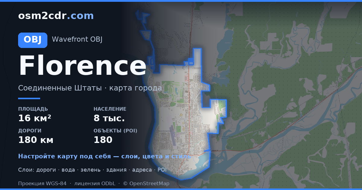
Map of Florence in OBJ format
Peta yang dibangun dari data OpenStreetMap, siap diunduh
Sesuaikan peta untuk Anda
Buka area tempat ini di konstruktor dan sesuaikan semuanya dengan kebutuhan Anda
Buka di konstruktor →Informasi peta
Apa isi peta ini secara default
Beginilah peta dibangun «apa adanya» — setiap pengaturan dapat diubah di konstruktor.
Tentang OBJ
Peta Florence dalam format OBJ — ekspor data OpenStreetMap nyata untuk area yang dipilih.
Wavefront OBJ is a universal 3D model format with material support. Buildings are exported with texture coordinates and groups by type.
Lapisan apa saja yang ada di file
File ini untuk area yang dipilih berisi:
- Jalan
- Bangunan
- Air
- Penghijauan
- Titik menarik
Sistem koordinat
WGS 84 (EPSG:4326), dapat dipilih di wizard
Kompatibilitas
Satuan ukuran
Meter (diproyeksikan dalam sistem koordinat yang dipilih)
| Kategori | 3D |
| Ekstensi file | .obj |
| Tingkat | Free |
What's in the OBJ map of Florence
5,169 buildings (59 residential, 34 commercial, 1 industrial, 2 religious), 180.9 km of roads, 180 points of interest, 12 landmarks.
Mostly residential streets 77.8 km, service roads 44.0 km, tertiary roads 29.2 km.
16.4% of the area is green space.
Key amenities: schools — 7, pharmacies — 4, convenience stores — 5.
3D scene with 5,169 buildings for Blender, Cinema 4D, and other 3D editors.
Main streets: North Fork Siuslaw Road, Kingwood Street, North Rhododendron Drive, Rhododendron Drive, Heceta Beach Road
Landmarks: Oregon Coast Military Museum, Siuslaw Pioneer Museum, C.R.O.W. Center for the Performing Arts, The River Gallery, The Laughing Crab Gallery & Tasting Room
Cara menggunakan OBJ untuk Florence
- Pilih area peta Florence di halaman utama
- Pilih format OBJ dan atur opsi ekspor
- Klik «Ekspor» dan tunggu hingga selesai
- Unduh file yang sudah siap dan gunakan di aplikasi Anda


