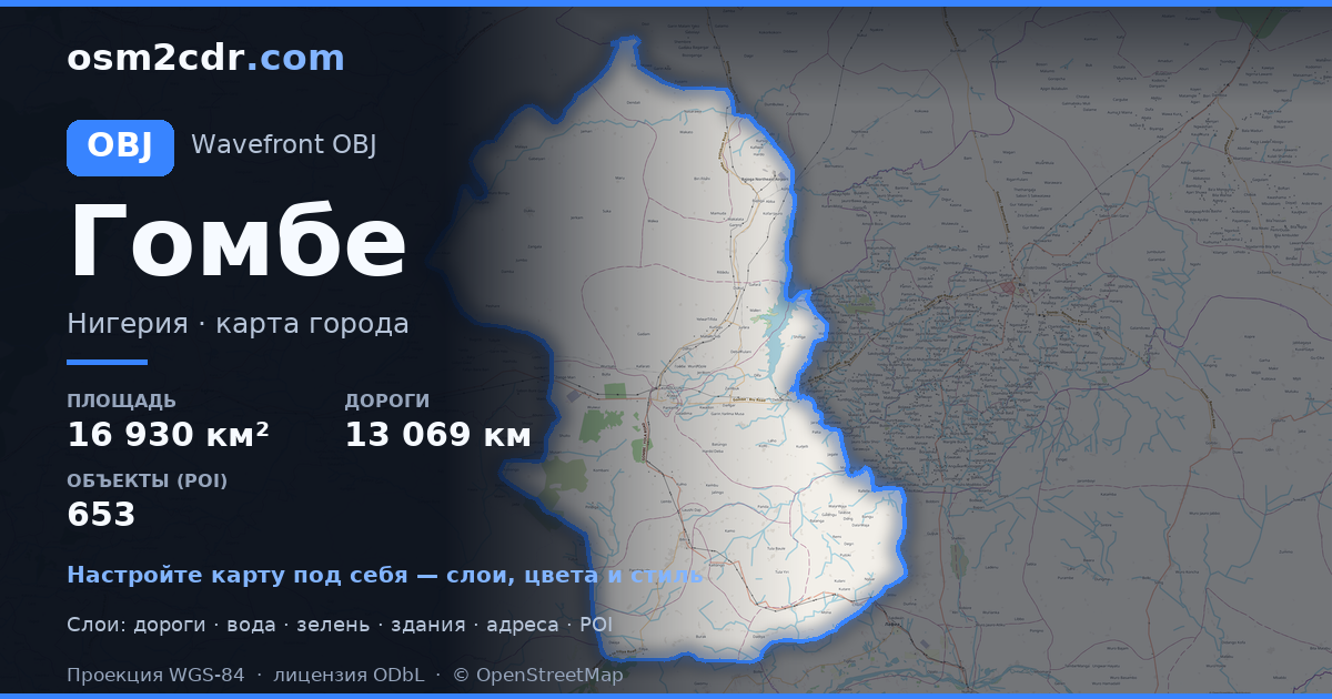
Gombe State का OBJ प्रारूप नक्शा
OpenStreetMap डेटा से बना मानचित्र, डाउनलोड के लिए तैयार
मानचित्र अनुकूलित करें
इस स्थान का क्षेत्र कंस्ट्रक्टर में खोलें और सब कुछ अपनी आवश्यकता अनुसार समायोजित करें
कंस्ट्रक्टर में खोलें →मानचित्र पासपोर्ट
इस मानचित्र में डिफ़ॉल्ट रूप से क्या है
इस तरह मानचित्र "जैसा है" बनता है — हर सेटिंग कंस्ट्रक्टर में बदली जा सकती है।
OBJ के बारे में
Gombe State का मानचित्र OBJ में — चयनित क्षेत्र के लिए वास्तविक OpenStreetMap डेटा का निर्यात।
Wavefront OBJ is a universal 3D model format with material support. Buildings are exported with texture coordinates and groups by type.
फ़ाइल में कौन-कौन सी लेयर हैं
चयनित क्षेत्र के लिए इस फ़ाइल में शामिल हैं:
- सड़कें
- इमारतें
- जल
- हरियाली
- रुचि के बिंदु
निर्देशांक प्रणाली
WGS 84 (EPSG:4326), विज़ार्ड में चयन योग्य
संगतता
इकाइयाँ
मीटर (चयनित निर्देशांक प्रणाली में प्रक्षेपित)
| श्रेणी | 3D |
| फ़ाइल एक्सटेंशन | .obj |
| स्तर | Free |
What's in the OBJ map of Gombe State
308,574 buildings (345 residential, 58 commercial, 3 industrial, 4 religious), 13,069.3 km of roads, 653 points of interest, 15 landmarks.
Mostly unclassified roads 7,016.3 km, residential streets 3,749.6 km, tertiary roads 965.2 km.
1.5% of the area is green space.
Key amenities: colleges — 18, schools — 75, libraries — 8.
3D scene with 308,574 buildings for Blender, Cinema 4D, and other 3D editors.
Main streets: Gombe - Potiskum Road, Mutum Daya to Filiya Road, Gombe - Biu Road, Gombe - Potiskum Road; Ashaka Bajago Road, TUMU KASHERE ROAD
Landmarks: Zoological park, Emir Palace Tangale, District Head Kalmai, WELCOME TO GOMBE CENTRAL GATE, Field 2
Gombe State के लिए OBJ का उपयोग कैसे करें
- मुख्य पृष्ठ पर Gombe State मानचित्र क्षेत्र चुनें
- OBJ प्रारूप चुनें और निर्यात सेटिंग्स कॉन्फ़िगर करें
- निर्यात पर क्लिक करें और प्रसंस्करण की प्रतीक्षा करें
- फ़ाइल डाउनलोड करें और अपने एप्लिकेशन में उपयोग करें


