Map of Midlands Province in OBJ format
A map built from OpenStreetMap data, ready to download
Customize the map
Open this place's area in the constructor and adjust everything to your needs
Open in constructor →Map passport
What this map contains by default
This is how the map is built as-is — every setting can be changed in the constructor.
About OBJ
Map of Midlands Province in OBJ — an export of real OpenStreetMap data for the selected area.
Wavefront OBJ is a universal 3D model format with material support. Buildings are exported with texture coordinates and groups by type.
Which layers are in the file
This file for the selected area contains:
- Roads
- Buildings
- Water
- Greenery
- Points of interest
Coordinate systems
WGS 84 (EPSG:4326), selectable in the wizard
Compatibility
Units
Meters (projected in the chosen coordinate system)
| Category | 3D |
| File extension | .obj |
| Tier | Free |
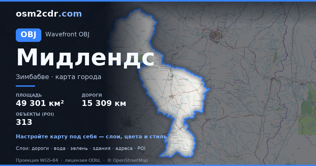
What's in the OBJ map of Midlands Province
1,036,525 buildings (1,852 residential, 39 commercial, 28 industrial, 6 religious), 15,309.0 km of roads, 313 points of interest, 15 landmarks.
The area covers 49,301 km², with about 21 buildings per km².
Mostly unclassified roads 8,492.5 km, tertiary roads 2,574.7 km, residential streets 1,710.7 km.
The map marks 10 water bodies.
Key amenities: schools — 60, hospitals — 6, clinics — 43.
Public transport: 16 bus stops, 10 rail stations.
3D scene with 1,036,525 buildings for Blender, Cinema 4D, and other 3D editors.
Main streets: Kwekwe-Gokwe Road, Silobela Road, Kwekwe-Mvuma, Robert Mugabe Road, Somalala-Sidakeni Road
Landmarks: Boggie's Clock Tower, Stock Exchange Building, National Mining Museum, Kwekwe Mining Museum, Invhukuvanhu BC
How to use OBJ for Midlands Province
- Select the Midlands Province map area on the main page
- Choose OBJ format and configure export settings
- Click Export and wait for processing
- Download the file and use in your application


