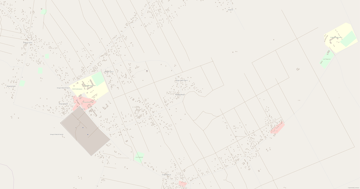
Map of Point E Block A1
Village · Terego
A ready-made vector map with buildings, roads and features — for CAD, GIS and print. Download after signing in.
Point E Block A1 is a village with water in the district: the lies a few hundred metres past the edge of town — the water nearby brings cool air in the heat and a quiet view year-round. Besides, Point E Block A1 stands in hilly country — the view from the rises is open and wide. What is more, Point E Block A1 is no empty place: there is a school and a shop working here.
Map passport
Open the area of Point E Block A1 in the constructor and change layers, style, format and coordinate system for your task.
Open in constructorMap defaults
This is how the map is built by default — every parameter can be changed in the constructor.
Download the map of Point E Block A1 in 140 formats
The same OpenStreetMap dataset — in the format for your software. Pick by task: CAD, vector, GIS, 3D or print.
Location of Point E Block A1
Distance and direction to the nearest centres
Point E Block A1 lies 3.1 km to the west of Udupi.
- Nearest city
- Udupi — 3.1 km to the west
- Region centre
- Terego — 14.5 km to the west
Maps of Terego
Nearby cities and districts — every map is ready to download.




Neighbouring places and regions
Browse to neighbouring cities, districts and regions — each has a ready-made vector map in the same formats.

About Point E Block A1
Analytical Portrait: Point E Block A1 Point E Block A1 spans 2.0 km² and contains 318 buildings. Strengths 72/100 Commerce Well-developed commercial infrastructure 60/100 Education Adequate educational institutions 58/100 Connectivity Average road network connectivity
What's inside the map of Point E Block A1
The map covers the entire area of Point E Block A1 within administrative boundaries. Each layer can be turned on or off before download.
What's around
Forest, water, services and roads nearby
🌳 Nature
- 🌲Forest7.7 km
- 💧River978 m
- 🌊Lake3.3 km
- 🏖️Sea coast50 km
🏢 Services
- 🏫Schoolin the village
- 🧸Kindergarten1.4 km
- 🛒Shopin the village
- 💊Pharmacy245 m
- 🏥Hospital3 km
🛣️ Road
- 🏙️City Udupi3.1 km W
- 🚉Railway station50 km
Relief
★ new · from relief mapsElevation and terrain character
Elevations are computed from digital elevation models (Copernicus GLO-30). Elevation drop — 69 m.
What the map of Point E Block A1 looks like
The same place in three render styles. Buildings, roads, water and greenery carry over into every format losslessly.
Infrastructure of Point E Block A1
What's on the territory according to OpenStreetMap data.
How the map is used
The same dataset for Point E Block A1 — for different tasks: from drafting to 3D printing.
Streets and roads
Roads classified by type — according to OpenStreetMap data.
The street network of Point E Block A1 — 20 km of roads according to OpenStreetMap data, classified by type.
Restaurants and cafés
Food and drink venues according to OpenStreetMap data.
In Point E Block A1, OpenStreetMap records 1 food and drink venues — restaurants, cafés, bars and fast-food outlets.
Shops and retail
Retail according to OpenStreetMap data.
In Point E Block A1, OpenStreetMap records 10 shops and retail outlets. Main categories: Convenience, Tailor, Beverages, Kiosks, Shoes, Bicycles.
Education
Schools, universities and libraries according to OpenStreetMap data.
Schools: African Child Care School, Awa Primary School.
Healthcare
Hospitals, pharmacies and clinics according to OpenStreetMap data.
Hospitals of Point E Block A1: Imvepi Health Centre II.
What's on the map
Each layer of the Point E Block A1 map can be turned on or off before download.
Key figures
A summary based on OpenStreetMap data for Point E Block A1.
Compared to neighbours
How the place compares to neighbours within a 30-kilometre radius.
1251 places within a 30 km radius to compare.