Map of Albania in G-code format
A map built from OpenStreetMap data, ready to download
Customize the map
Open this place's area in the constructor and adjust everything to your needs
Open in constructor →Map passport
What this map contains by default
This is how the map is built as-is — every setting can be changed in the constructor.
About G-code
Map of Albania in G-code — an export of real OpenStreetMap data for the selected area.
G-code is a CNC and laser engraver control language. Maps are converted to toolpaths for laser cutting or engraving.
Which layers are in the file
This file for the selected area contains:
- Roads
- Buildings
- Water
- Greenery
- Points of interest
Coordinate systems
WGS 84 (EPSG:4326), selectable in the wizard
Compatibility
Units
Meters (projected in the chosen coordinate system)
| Category | GIS |
| File extension | .gcode |
| Tier | Free |
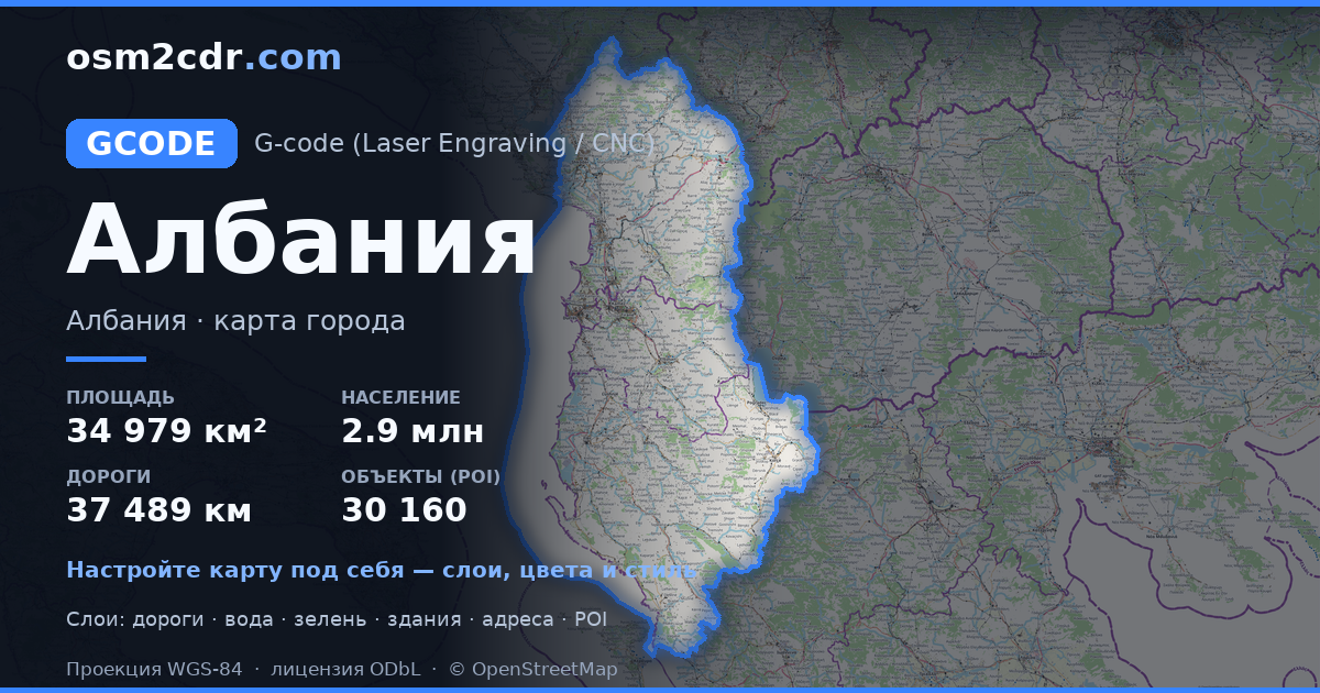
What's in the G-code map of Albania
228,130 buildings (10,685 residential, 875 commercial, 1,242 industrial, 180 religious), 37,489.3 km of roads, 30,160 points of interest, 100 landmarks.
Mostly residential streets 14,645.3 km, unclassified roads 8,885.0 km, service roads 5,102.4 km.
Key amenities: schools — 874, pharmacies — 800, supermarkets — 1,074.
Main streets: Librazhd - Çerenec, Rruga e Arbërit, Rruga Nacionale Fier-Berat, Rruga e Lumit të Vlorës, Superstradë Qukës–Qafë Plloçë
Landmarks: Muzeu i Shkollës Normale të Elbasanit, Muzeu Kombëtar Ikonografik Onufri, Muzeu Arkeologjik Durrës, Muzeu Historik,Bajram Curri, Muzeu Etnografik Kukës
How to use G-code for Albania
- Select the Albania map area on the main page
- Choose G-code format and configure export settings
- Click Export and wait for processing
- Download the file and use in your application
