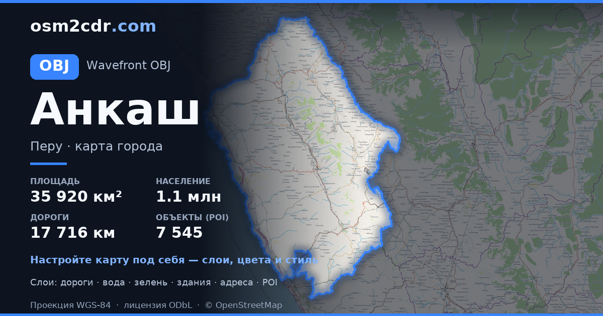
Map of Ancash in OBJ format
A map built from OpenStreetMap data, ready to download
Customize the map
Open this place's area in the constructor and adjust everything to your needs
Open in constructor →Map passport
What this map contains by default
This is how the map is built as-is — every setting can be changed in the constructor.
About OBJ
Map of Ancash in OBJ — an export of real OpenStreetMap data for the selected area.
Wavefront OBJ is a universal 3D model format with material support. Buildings are exported with texture coordinates and groups by type.
Which layers are in the file
This file for the selected area contains:
- Roads
- Buildings
- Water
- Greenery
- Points of interest
Coordinate systems
WGS 84 (EPSG:4326), selectable in the wizard
Compatibility
Units
Meters (projected in the chosen coordinate system)
| Category | 3D |
| File extension | .obj |
| Tier | Free |
What's in the OBJ map of Ancash
61,030 buildings (3,829 residential, 60 commercial, 184 industrial, 421 religious), 17,716.4 km of roads, 7,545 points of interest, 15 landmarks.
The area covers 35,920 km², with about 2 buildings per km².
Mostly tertiary roads 5,445.8 km, unclassified roads 5,022.8 km, residential streets 2,856.0 km.
0.3% of the area is green space.
The map marks 5 parks and 10 water bodies.
Key amenities: schools — 2,093, kindergartens — 1,607, clinics — 91.
Public transport: 262 bus stops, 1 rail stations.
3D scene with 61,030 buildings for Blender, Cinema 4D, and other 3D editors.
Main streets: Carretera Longitudinal de Conchucos, Carretera Samanco - Caraz, Carretera Huarmey - Recuay, Carretera Longitudinal de la Sierra Norte, Carretera a Laguna de Parón
Landmarks: Museo de Sitio Augusto Soriano Infante, Parque Litico, Boleteria Chavín, Willkawaín, Museo Punkuri
How to use OBJ for Ancash
- Select the Ancash map area on the main page
- Choose OBJ format and configure export settings
- Click Export and wait for processing
- Download the file and use in your application


