osm2cdr.com
Ready map · OSM data

Map of Panama

Country · 166,279 km2

A ready-made vector map with buildings, roads and features — for CAD, GIS and print. Free, no registration.

Choose a format
Download · PDF, ≈ 1.7 MB
All 135 formats Customize your area
133 formatsOSM datano registrationfree
N
© OpenStreetMap
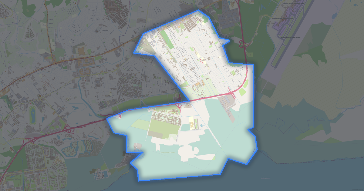
Boundary · Panama · OpenStreetMap
BuildingsRoadsWaterGreeneryBoundary

Map passport

166,279 km2
Area
74 788
Buildings
36 336 km
Roads
19 985
Points of interest
Customize the map for yourself

Open the area of Panama in the constructor and change layers, style, format and coordinate system for your task.

Open in constructor

Map defaults

This is how the map is built by default — every parameter can be changed in the constructor.

Format
PDF choose
Layers
Roads, Buildings, Water, Greenery, POIchange
Style
Standard (colour)change
Detail
overview (auto)change
House numbers
not visible at this scalechange
Points of interest
not visible at this scalechange
Coordinate system
WGS 84 (auto)change
Sheet size
Relief and grid

Download the map of Panama in 135 formats

The same OpenStreetMap dataset — in the format for your software. Pick by task: CAD, vector, GIS, 3D or print.

Popular formatsthe most common formats
MOST COMMON
PDFfor printing and viewing.pdf · ≈ 2.1 MB
CDRfor CorelDRAW.cdr · ≈ 325 KB
SVGfor Illustrator, Inkscape, web.svg · ≈ 2.4 MB
GeoJSONfor QGIS and web maps.geojson · ≈ 5.4 MB
DWGfor AutoCAD, nanoCAD, BricsCAD.dwg · 1.6 MB
CADdrafting and design
DWGFREE
AutoCAD.dwg · 1.6 MB
DXFFREE
CAD exchange.dxf · ≈ 9 MB
CDRFREE
CorelDRAW.cdr · ≈ 391 KB
DGNFREE
MicroStation.dgn · ≈ 1.7 MB
Vectorillustration and web
SVGFREE
Web · vector.svg · ≈ 2.9 MB
AIFREE
Illustrator.ai · ≈ 2.4 MB
EPSFREE
Print production.eps · ≈ 2.3 MB
PDFFREE
Vector · print.pdf · ≈ 2.5 MB
GISgeo-referenced data
GeoJSONFREE
GIS · data.geojson · ≈ 6.7 MB
ShapefileFREE
QGIS · ArcGIS.shp · ≈ 868 KB
KMLFREE
Google Earth.kml · ≈ 6.5 MB
GeoPackageFREE
GeoPackage.gpkg · ≈ 3.7 MB
3Dvolume and models
STLFREE
3D printing.stl · ≈ 168 KB
OBJFREE
3D model.obj · 1 KB
glTFFREE
3D · web.gltf · ≈ 121 KB
DAEFREE
Collada.dae · ≈ 112 KB
Printraster and layouts
PNGFREE
Raster · transparency.png · ≈ 2 MB
JPGFREE
Raster.jpg · ≈ 512 KB
PDFFREE
Print layout.pdf · ≈ 2.5 MB
TIFFFREE
Print production.tif · ≈ 4.7 MB
Open all 135 formats

Maps of Panama

All places within the territory — every map is ready to download.

Regions · 14

Major cities · 100

Panamá
Panamá
City · 1.1M
Agua Fría
Agua Fría
City
Cañita
Cañita
City
Cristóbal
Cristóbal
City
El Llano
El Llano
City
Llano Grande
Llano Grande
City
Metetí
Metetí
City
Río Indio
Río Indio
City
Santa Cruz de Chinina
City
Santa Fe
Santa Fe
City
Toabré
Toabré
City
Tortí
Tortí
City
Yaviza
Yaviza
City
Boca del Monte
Boca del Monte
City
Pacora
Pacora
City
Chiguirí Arriba
Chiguirí Arriba
City
Salamanca
Salamanca
City
Omar Torrijos Herrera
City
Tulú
Tulú
City
Ancón
Ancón
City
Las Garzas
Las Garzas
City
Natá
Natá
City
Santiago Sur
Santiago Sur
City
Calidonia
Calidonia
City
El Alto
El Alto
City
Río Grande
Río Grande
City
Caldera
Caldera
City
Emplanada de Chorcha
City
San Martín
San Martín
City
El Coco
El Coco
City
Piedras Gordas
Piedras Gordas
City
Pajonal
Pajonal
City
La Yeguada
La Yeguada
City
La Soledad
La Soledad
City
La Peña
La Peña
City
Coclé
Coclé
City
Los Naranjos
Los Naranjos
City
David
David
City · 156K
Ciricito
Ciricito
City
Capellanía
Capellanía
City
Gatú
Gatú
City
Alto Boquete
Alto Boquete
City
La Laguna
La Laguna
City
Toza
Toza
City
El Caño
El Caño
City
El Cuay
El Cuay
City
La Pava
La Pava
City
La Pintada
La Pintada
City
Olá
Olá
City
Colón
Colón
City · 280K
24 de Diciembre
24 de Diciembre
City
Calobre
Calobre
City
La Chorrera
La Chorrera
City · 258K
Guzmán
Guzmán
City
San José
San José
City
San Francisco
San Francisco
City
El Cocla
El Cocla
City
El Potrero
El Potrero
City
Jaramillo
Jaramillo
City
Arraiján
Arraiján
City
Chilibre
Chilibre
City
Cañaveral
Cañaveral
City
Tocumen
Tocumen
City
San Juan
San Juan
City
Bocas del Toro
Bocas del Toro
City
Penonomé
Penonomé
City
Bugaba
Bugaba
City · 78K
Veracruz
Veracruz
City
Alcalde Díaz
Alcalde Díaz
City
Boquerón
Boquerón
City
Chitré
Chitré
City · 60K
Barú
Barú
City · 56K
El Valle
El Valle
City
Ernesto Córdoba Campos
City
Santiago Este
Santiago Este
City
Pedregal
Pedregal
City
Las Cumbres
Las Cumbres
City
Cativá
Cativá
City
Las Mañanitas
Las Mañanitas
City
Nuevo Santiago
Nuevo Santiago
City
David Sur
David Sur
City · 33K
Santiago
Santiago
City · 31K
Juan Díaz
Juan Díaz
City
Bajo Boquete
Bajo Boquete
City
David Este
David Este
City · 27K
Don Bosco
Don Bosco
City
Rodrigo Luque
Rodrigo Luque
City
Las Lomas
Las Lomas
City · 25K
Sabanitas
Sabanitas
City
La Concepción
La Concepción
City · 21K
Rufina Alfaro
Rufina Alfaro
City
Taboga
Taboga
City
Omar Torrijos
Omar Torrijos
City
San Martín de Porres
City · 16K
San Pablo Viejo
San Pablo Viejo
City · 16K
Canto del Llano
Canto del Llano
City · 13K
Bethania
Bethania
City
Puerto Armuelles
Puerto Armuelles
City · 12K
Progreso
Progreso
City · 11K
Parque Lefevre
Parque Lefevre
City

Neighbouring places and regions

Browse to neighbouring cities, districts and regions — each has a ready-made vector map in the same formats.

Neighboring countries

Colombia837 km · CountryCosta Rica837 km · Country
Map of Panama
Panama

About Panama

Panama is a ready-made vector map based on OpenStreetMap data. It is not an image but structured layers of buildings, roads, water bodies, greenery and points of interest that can be edited in any professional software. The map territory covers an area of 166,279 km2 within administrative boundaries.

The map includes 74 788 buildings, 36 336 km of roads and streets and 19 985 points of interest. Each layer can be turned on or off before download, and the data preserves the original OpenStreetMap classification. Green areas cover about 66.5% of the territory.

The map works well as an underlay in AutoCAD and CorelDRAW, for loading layers into QGIS and ArcGIS, preparing printed schemes and plans, or as a basis for design and navigation. More than 130 formats are available — from DWG, DXF and SVG to GeoJSON, Shapefile and 3D models, in the WGS 84 coordinate system.

74 788buildings
36 336 kmroads and streets
19 985features
135formats
WGS 84coordinate system

What's inside the map of Panama

The map covers the entire area of Panama within administrative boundaries — 166,279 km2. Green areas cover 66.5% of the territory. Each layer can be turned on or off before download.

74 788buildings
Buildings on separate layers
residential28975
commercial2419
industrial1222
36 336km
Roads with classification
trunk roads1 251 km
primary roads1 228 km
service roads2 592 km
19 985POI
Points of interest
bars410
Yes959
banks450
Main streets
Carretera PanamericanaCarretera TransístmicaCarretera Dorindo CárdenasVía Soná - ToléVía Gualaca - RambálaPaso Canoas-Puerto Armuelles
Landmarks · 6
Museo de Historia de Panamá
Museo Padre José Noto
Explora
Museo de Chitre
Museo Regional de Gualaca
Regional de Veraguas

What the map of Panama looks like

The same place in three render styles. Buildings, roads, water and greenery carry over into every format losslessly.

Blueprint (CAD) — map of Panama
Blueprint (CAD)
Outlines on a dark background — for DWG and DXF
Standard vector — map of Panama
Standard vector
A colour map with buildings, roads and greenery
Print layout — map of Panama
Print layout
A ready layout for PDF and print production

Infrastructure of Panama

What's on the territory according to OpenStreetMap data.

3 381
Dining
9 539
Shops
988
Hotels
1 950
Transport
651
Parks
1 520
Water

Density and saturation

How many features there are per square kilometre — according to OpenStreetMap data.

0
bld/km²
0,2
km/km²
0
POI/km²
66,5%
greenery

How the map is used

The same dataset for Panama — for different tasks: from drafting to 3D printing.

Architecture and design
An underlay and building outlines for drawings and layouts.
DWG / DXF
Design and illustration
A vector map base for posters, schemes and identity design.
SVG / AI
GIS and analysis
Geo-referenced layers for QGIS, ArcGIS and spatial analysis.
GeoJSON / SHP
3D printing and models
Relief of buildings and terrain for printing and visualization.
STL
Navigation and tracks
Map data for navigators and route apps.
Garmin
Print and publishing
A ready map layout for print production.
PDF

Landmarks

Museums, monuments and notable places of Panama according to OpenStreetMap data — each with a link to the map.

🏛️
Museo de Historia de Panamá
MuseumOSM
🏛️
Museo Padre José Noto
MuseumOSM
🏛️
Explora
MuseumOSM
🏛️
Museo de Chitre
MuseumOSM
🏛️
Museo Regional de Gualaca
MuseumOSM
🏛️
Regional de Veraguas
MuseumOSM
🏛️
Museo del Canal Interoceanico de Panama
MuseumOSM
🏛️
Museo de la Sal y el Azucar - Stella Sierra
MuseumOSM
🏛️
Centro de Visitantes de Miraflores
MuseumOSM
🏛️
Casa Museo Banco Nacional
MuseumOSM
🏛️
Museo Afroantillano
MuseumOSM
🏛️
museo de la villa de los santos
MuseumOSM
🏛️
Fundación Cultural Gallegos
MuseumOSM
🏛️
Museo del Barrio y Antigüedades La Casona
MuseumOSM
🏛️
Museo de Ciencias Naturales
MuseumOSM
🏛️
Museo de La Chorrera
MuseumOSM
🏛️
Museo de la Mola
MuseumOSM
🏛️
Museo de Arte Religioso [Antiguo Convento de Santo Domingo]
MuseumOSM
🏛️
Antiguo Museo José Domingo de Obaldia
MuseumOSM
🏛️
Guna yala museo
MuseumOSM
🏛️
Museo de Arte Contemporaneo
MuseumOSM
🏛️
Fundación Museo Arias Madrid
MuseumOSM
🏛️
Museo de la cultura democratica
MuseumOSM
🏛️
Museum Belisario Porras
MuseumOSM

Nature and green areas

Parks, squares and water bodies of Panama according to OpenStreetMap data — everything is carried into the map as separate layers.

136708,5
km² of greenery
66,5%
green coverage
651
parks
1 520
water bodies
Parks and squares
Parque Natural Metropolitano · 153 ha
Parque Recreativo y Cultural Omar · 55 ha
Parque Municipal Summit · 45 ha
Conjunto Monumental de Panama Viejo · 30 ha
Cerro Sosa · 28 ha
Water bodies
Lago Gatún · lake
Lago Bayano · lake
Lago Alajuela · lake
Río Viejo · lake
Lago Chan 75 - Represa Chan 75 · lake
Canal de Panamá · canal
Río Chucunaque · river
Río Tuira · river

Public transport

Stops and stations according to OpenStreetMap data.

1 816
bus stops
3
rail stations
96
tram stops
35
metro stations

Public transport of Panama includes 1 816 bus stops, 3 rail stations, 96 tram stops and 35 metro stations. All stops and stations are included in the map as a separate layer.

Streets and roads

Roads classified by type — according to OpenStreetMap data.

12677,3 km
unclassified roads
12013,4 km
residential streets
3978,7 km
tertiary roads
2592,9 km
service roads
1617,5 km
secondary roads
1251,2 km
trunk roads
1228 km
primary roads
565,9 km
living streets

The street network of Panama — 36 336 km of roads according to OpenStreetMap data, classified by type.

Named streets
Carretera Panamericana · 150,4 km
Carretera Transístmica · 106 km
Carretera Dorindo Cárdenas · 83,3 km
Vía Soná - Tolé · 73,2 km
Vía Gualaca - Rambála · 71,9 km
Paso Canoas-Puerto Armuelles · 67,4 km
Vía Boquete · 66,7 km
Vía Dr. Belisario Porras · 64 km

Restaurants and cafés

Food and drink venues according to OpenStreetMap data.

2 043
restaurants
350
cafés
450
bars
538
fast food

In Panama, OpenStreetMap records 3 381 food and drink venues — restaurants, cafés, bars and fast-food outlets.

Shops and retail

Retail according to OpenStreetMap data.

9 539
shops

In Panama, OpenStreetMap records 9 539 shops and retail outlets. Main categories: Convenience, Shops, Supermarkets, Car Repair, Clothes, Hardware.

Convenience2 106Shops964Supermarkets664Car Repair498Clothes482Hardware332Car Parts289Hairdressers250Bakeries244Beauty221

Education

Schools, universities and libraries according to OpenStreetMap data.

1 148
schools
127
universities
49
libraries
23
kindergartens

Schools: Academia Bilingüe Castillo de Vocales, Academia Bilingüe Montelimar, Academia Bilingüe Santa Fe, Academia Bilingüe Santa Mónica, Academia Comercial Hispanoamericana, Academia Forum, Academia Hebrea de Panamá, Academia Hosanna. Universities: Antiguo Colegio Javier, Centro Educativo Básico General Nele Kantule, Centro Educativo Básico General Victoriano Lorenzo, Centro Tecnológico de Panamá, Centro Técnico de Estudios Superiores, Colegio Adventista Bilingüe de David, Colegio Francisco Morazán, Colegio Félix Olivares Contreras. Libraries: Agencia Central Panameña de Publicaciones S.A., BP-Hortensio de Icaza, Bernardo Lombardo, Biblionet Ismael Villar, San Martin, Biblionet Parque Lefevre Miguel A. Ordoñez, Biblionet Rosa María Jaen Del Castillo, San Martin, Biblioteca, Biblioteca Central.

Healthcare

Hospitals, pharmacies and clinics according to OpenStreetMap data.

129
hospitals
395
pharmacies
476
clinics

Where to stay

Hotels, hostels and guest houses according to OpenStreetMap data.

988
accommodation places
Hotels and guest houses
Villa Ibiscus · Apartments
Selina Red Frog · Hostel
Palmar Beach Lodge · Hotel
Morillos eco resort · Hotel
Cabañas Torio · Motel
Bambuda Lodge · Hotel
Los Franche · Hotel
Cosmic Crab Resort · Hotel

What's on the map

Each layer of the Panama map can be turned on or off before download.

Map layers
Buildings: 74 788
Roads: 36 336 km
Points of interest: 19 985
Green areas: 136708,5 km²

Key figures

A summary based on OpenStreetMap data for Panama.

Buildings74 788
Residential buildings28 975
Commercial buildings2 419
Roads36 336 km
Green areas136708,5 km²
Green coverage66,5%
Food and drink venues3 381
Shops9 539
Points of interest19 985
Bus stops1 816
Rail stations3
Hospitals129
Pharmacies395
Landmarks100

Compared to neighbours

How the place compares to neighbours within a 30-kilometre radius.

43 places within a 30 km radius to compare.

🌿 Greenerypercentile 100 of 100
🛣️ Roadspercentile 0 of 100

Frequently asked questions

Open osm2cdr.com, select the target area on the map, choose a format, and start export. Most maps are ready in 1-5 minutes.
Map of Panama is available in 135 formats: CDR, DWG, DXF, SVG, AI, EPS, PDF, PNG, GeoJSON, KML, Shapefile, GeoTIFF and others.
Yes. The full map of Panama is free to export during Open Beta — all 135 formats, no area limits, no registration.
The service uses OpenStreetMap data, updated monthly.
Generation time depends on the area size. You will receive an email notification when ready.