Map of Qortuba in OBJ format
A map built from OpenStreetMap data, ready to download
Customize the map
Open this place's area in the constructor and adjust everything to your needs
Open in constructor →Map passport
What this map contains by default
This is how the map is built as-is — every setting can be changed in the constructor.
About OBJ
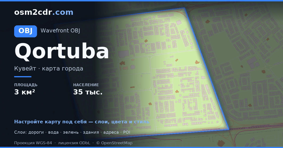
Map of Qortuba in OBJ — an export of real OpenStreetMap data for the selected area.
Wavefront OBJ is a universal 3D model format with material support. Buildings are exported with texture coordinates and groups by type.
Which layers are in the file
This file for the selected area contains:
- Roads
- Buildings
- Points of interest
Coordinate systems
WGS 84 (EPSG:4326), selectable in the wizard
Compatibility
Units
Meters (projected in the chosen coordinate system)
| Category | 3D |
| File extension | .obj |
| Tier | Free |
What's in the OBJ map of Qortuba
1,987 buildings (1,918 residential, 3 commercial, 9 religious), 76.0 km of roads, 30 points of interest, 9 landmarks.
The area covers 3.3 km², with about 611 buildings per km².
Mostly residential streets 36.0 km, service roads 14.0 km, tertiary roads 11.0 km.
Key amenities: schools — 5, supermarkets — 1, convenience stores — 1.
3D scene with 1,987 buildings for Blender, Cinema 4D, and other 3D editors.
Main streets: شارع 1, شارع دمشق, شارع 1 جادة 3, شارع عبدالعزيز فيصل الثويني, شارع 4
Landmarks: بدرية الوقيان, حصة محمد إبراهيم الغانم, عبدالمحسن عبدالعزيز البابطين, مسجد علي إبراهيم الكليب, محمد سعود الفليج
How to use OBJ for Qortuba
- Select the Qortuba map area on the main page
- Choose OBJ format and configure export settings
- Click Export and wait for processing
- Download the file and use in your application


