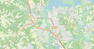
Map of Smithfield in CSV format
A map built from OpenStreetMap data, ready to download
Customize the map
Open this place's area in the constructor and adjust everything to your needs
Open in constructor →Map passport
What this map contains by default
This is how the map is built as-is — every setting can be changed in the constructor.
.csv
About CSV
Map of Smithfield in CSV: 4 438 buildings, 237 km of roads, 661 points of interest, 52% green areas — in the WGS 84 coordinate system, units are meters.
Which layers are in the file
This file for the selected area contains:
- Roads
- Buildings
- Water
- Greenery
- Points of interest
Geometry by layer
- Roads — table rows with WKT geometry (LineString)
- Buildings — table rows with WKT geometry (Polygon)
- Water — table rows with WKT geometry (Polygon)
- Greenery — table rows with WKT geometry (Polygon)
- Points of interest — table rows with coordinates and tags
What the file carries
The CSV file for Smithfield: the whole map comes as a single file, the file is plain text and opens in any editor, all features lie in one collection, and the source layer name stays in the _layer field, the geometry is written as a WKT string in its own column, OpenStreetMap tags are kept as feature attributes.
File size
The expected size of the CSV file for Smithfield is about 3.6 MB; the exact size depends on the chosen layers and area.
Coordinate systems
WGS 84 (EPSG:4326), selectable in the wizard
Compatibility
Units
Meters (projected in the chosen coordinate system)
| Category | GIS |
| File extension | .csv |
| Tier | Open Beta |
What's in the CSV map of Smithfield
4,438 buildings (2,879 residential, 50 commercial, 22 industrial, 3 religious), 237.0 km of roads, 661 points of interest, 17 landmarks.
The area covers 28 km², with about 161 buildings per km².
Mostly service roads 101.4 km, residential streets 85.8 km, tertiary roads 16.8 km.
51.5% of the area is green space.
The map marks 6 parks and 7 water bodies.
Key amenities: convenience stores — 6, restaurants — 12, fast food — 9.
Public transport: 1 bus stops.
Table with 661 points of interest and coordinates. Opens in Excel, Google Sheets, and any GIS.
Main streets: Courthouse Highway, Great Spring Road, Waterworks Road, Cypress Creek Parkway, South Church Street
Landmarks: 1750 Isle of Wight Courthouse, The Schoolhouse Museum, Isle of Wight County Museum, Smithfield Little Theater, The Arts Center
How to use CSV for Smithfield
- Select the Smithfield map area on the main page
- Choose CSV format and configure export settings
- Click Export and wait for processing
- Download the file and use in your application