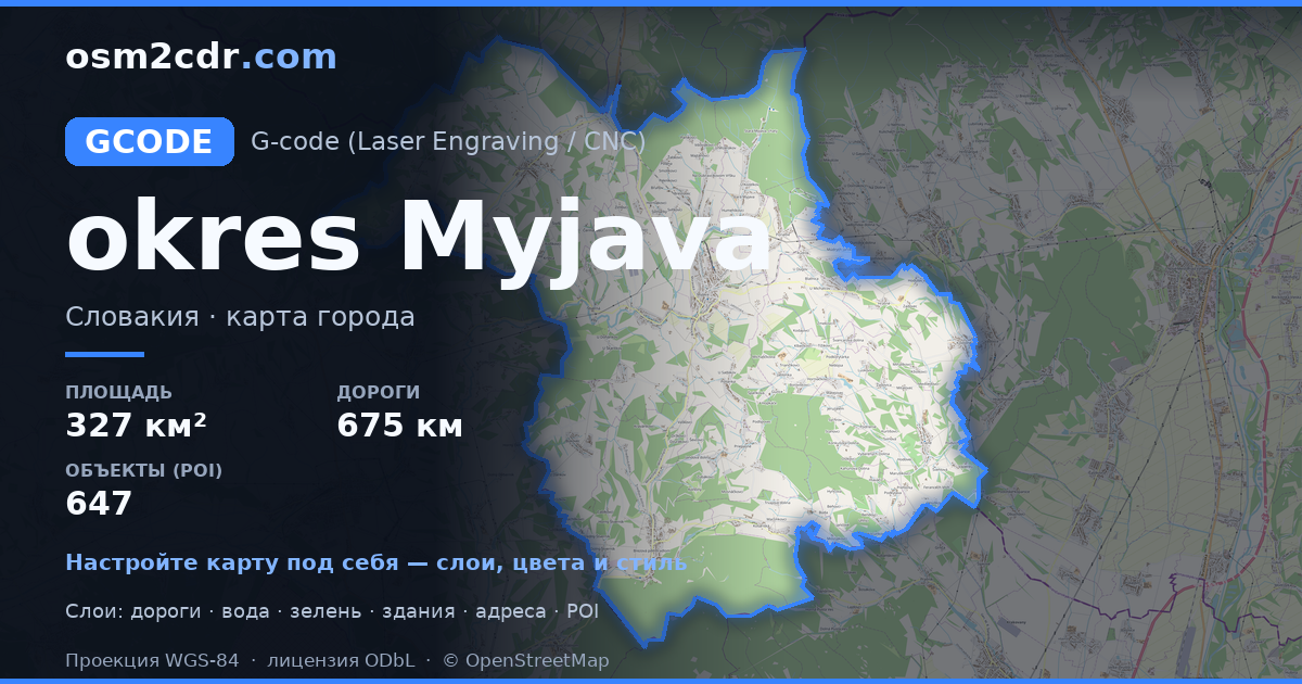
Map of District of Myjava in G-code format
A map built from OpenStreetMap data, ready to download
Customize the map
Open this place's area in the constructor and adjust everything to your needs
Open in constructor →Map passport
What this map contains by default
This is how the map is built as-is — every setting can be changed in the constructor.
About G-code
Map of District of Myjava in G-code — an export of real OpenStreetMap data for the selected area.
G-code is a CNC and laser engraver control language. Maps are converted to toolpaths for laser cutting or engraving.
Which layers are in the file
This file for the selected area contains:
- Roads
- Buildings
- Water
- Greenery
- Points of interest
Coordinate systems
WGS 84 (EPSG:4326), selectable in the wizard
Compatibility
Units
Meters (projected in the chosen coordinate system)
| Category | GIS |
| File extension | .gcode |
| Tier | Free |
What's in the G-code map of District of Myjava
18,697 buildings (411 residential, 27 commercial, 1 industrial, 15 religious), 675.3 km of roads, 647 points of interest, 30 landmarks.
The area covers 327 km², with about 57 buildings per km².
Mostly service roads 217.4 km, tertiary roads 182.3 km, residential streets 143.9 km.
53.2% of the area is green space.
The map marks 40 water bodies.
Key amenities: schools — 13, libraries — 10, supermarkets — 10.
Public transport: 205 bus stops, 6 tram stops, 7 rail stations.
Main streets: Žriedlová dolina, Jablonská, Staromyjavská, Moravská, Minárčiných
Landmarks: Múzeum Dušana Samuela Jurkoviča v Brezovej pod Bradlom, Múzeum Milana Rastislava Štefánika, Vrbovčianska izba, Múzeum SNR, Partizánske bunkre Zemľanky
How to use G-code for District of Myjava
- Select the District of Myjava map area on the main page
- Choose G-code format and configure export settings
- Click Export and wait for processing
- Download the file and use in your application


