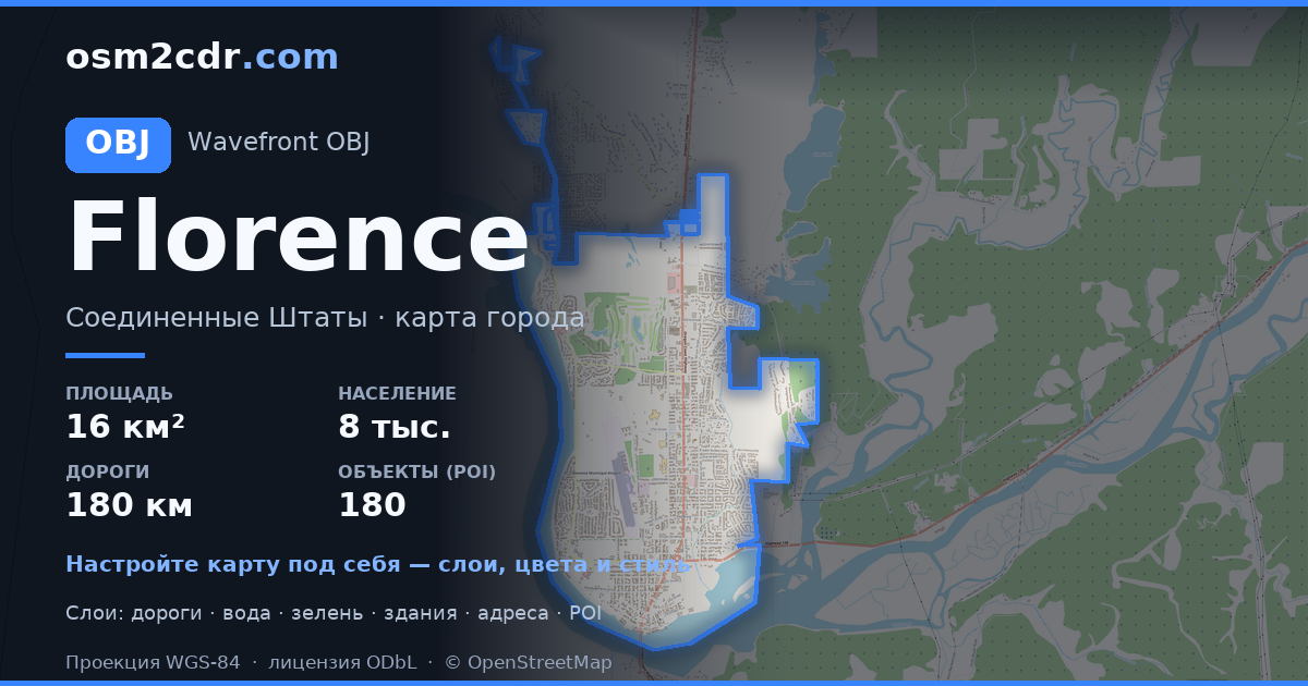
Map of Florence in OBJ format
A map built from OpenStreetMap data, ready to download
Customize the map
Open this place's area in the constructor and adjust everything to your needs
Open in constructor →Map passport
What this map contains by default
This is how the map is built as-is — every setting can be changed in the constructor.
About OBJ
Map of Florence in OBJ — an export of real OpenStreetMap data for the selected area.
Wavefront OBJ is a universal 3D model format with material support. Buildings are exported with texture coordinates and groups by type.
Which layers are in the file
This file for the selected area contains:
- Roads
- Buildings
- Water
- Greenery
- Points of interest
Coordinate systems
WGS 84 (EPSG:4326), selectable in the wizard
Compatibility
Units
Meters (projected in the chosen coordinate system)
| Category | 3D |
| File extension | .obj |
| Tier | Free |
What's in the OBJ map of Florence
5,169 buildings (59 residential, 34 commercial, 1 industrial, 2 religious), 180.9 km of roads, 180 points of interest, 12 landmarks.
Mostly residential streets 77.8 km, service roads 44.0 km, tertiary roads 29.2 km.
16.4% of the area is green space.
Key amenities: schools — 7, pharmacies — 4, convenience stores — 5.
3D scene with 5,169 buildings for Blender, Cinema 4D, and other 3D editors.
Main streets: North Fork Siuslaw Road, Kingwood Street, North Rhododendron Drive, Rhododendron Drive, Heceta Beach Road
Landmarks: Oregon Coast Military Museum, Siuslaw Pioneer Museum, C.R.O.W. Center for the Performing Arts, The River Gallery, The Laughing Crab Gallery & Tasting Room
How to use OBJ for Florence
- Select the Florence map area on the main page
- Choose OBJ format and configure export settings
- Click Export and wait for processing
- Download the file and use in your application


