Karte von Sikkim im G-code-Format
Karte aus OpenStreetMap-Daten, bereit zum Herunterladen
Karte anpassen
Bereich dieses Ortes im Konstruktor offnen und alles anpassen
Im Konstruktor offnen →Karten-Steckbrief
Was diese Karte standardmäßig enthält
So wird die Karte „wie sie ist“ zusammengestellt — jeder Parameter lässt sich im Konstruktor ändern.
Über G-code
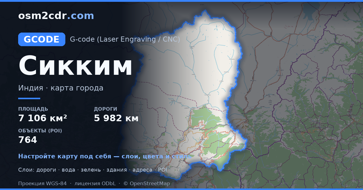
Karte von Sikkim im Format G-code — ein Export echter OpenStreetMap-Daten für den gewählten Bereich.
G-code is a CNC and laser engraver control language. Maps are converted to toolpaths for laser cutting or engraving.
Welche Ebenen die Datei enthält
Diese Datei enthält für den gewählten Bereich:
- Straßen
- Gebäude
- Wasser
- Grün
- Points of Interest
Koordinatensysteme
WGS 84 (EPSG:4326), im Assistenten wahlbar
Kompatibilität
Maßeinheiten
Meter (projiziert im gewählten Koordinatensystem)
| Kategorie | GIS |
| Dateierweiterung | .gcode |
| Tarif | Kostenlos |
What's in the G-code map of Sikkim
155,809 buildings (1,631 residential, 14 commercial, 16 industrial, 15 religious), 5,982.2 km of roads, 764 points of interest, 15 landmarks.
The area covers 7,106 km², with about 22 buildings per km².
Mostly unclassified roads 3,720.0 km, tertiary roads 1,013.8 km, trunk roads 435.1 km.
The map marks 5 parks and 10 water bodies.
Key amenities: schools — 14, hospitals — 15, clinics — 15.
Public transport: 17 bus stops.
Main streets: North Sikkim Highway, Gangtok - Assam - Pakyong Road, Rannipool - Rumtek - Sirwani Road, Gipmochi Highway, Penlong - Samdong Road
Landmarks: Sikkim high court museum (frequently closed), Namgyal Institute of Tibetology, Sculpture Shed, Museum on third floor, Black Cat Museum (Indian Army)
So verwenden Sie G-code für Sikkim
- Wählen Sie den Kartenbereich von Sikkim auf der Hauptseite aus
- Wählen Sie das Format G-code und konfigurieren Sie die Exporteinstellungen
- Klicken Sie auf „Exportieren“ und warten Sie auf den Abschluss
- Laden Sie die fertige Datei herunter und verwenden Sie sie im gewünschten Programm


