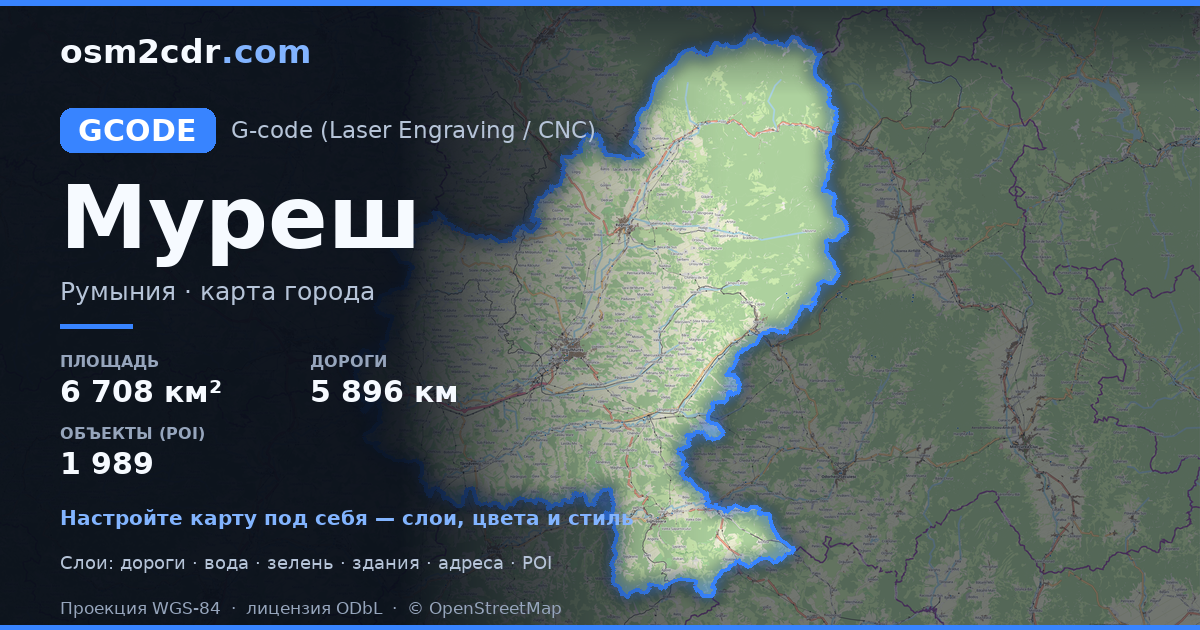
Kort over Mureș i G-code-format
Et kort bygget af OpenStreetMap-data, klar til download
Tilpas kortet
Åbn dette steds område i konstruktøren og tilpas alt til dit behov
Åbn i konstruktøren →Kortpas
Hvad dette kort indeholder som standard
Sådan bygges kortet som det er — hver indstilling kan ændres i konstruktøren.
Om G-code
Kort over Mureș i G-code — en eksport af rigtige OpenStreetMap-data for det valgte område.
G-code is a CNC and laser engraver control language. Maps are converted to toolpaths for laser cutting or engraving.
Hvilke lag er i filen
Denne fil indeholder for det valgte område:
- Veje
- Bygninger
- Vand
- Grønt
- Interessepunkter
Koordinatsystemer
WGS 84 (EPSG:4326), kan vælges i guiden
Kompatibilitet
Måleenheder
Meter (projiceret i det valgte koordinatsystem)
| Kategori | GIS |
| Filendelse | .gcode |
| Niveau | Gratis |
What's in the G-code map of Mureș
62,612 buildings (8,351 residential, 91 commercial, 366 industrial, 233 religious), 5,896.3 km of roads, 1,989 points of interest, 15 landmarks.
The area covers 6,708 km², with about 9 buildings per km².
Mostly residential streets 2,324.0 km, tertiary roads 837.8 km, secondary roads 734.5 km.
The map marks 5 parks and 10 water bodies.
Key amenities: schools — 51, pharmacies — 96, supermarkets — 66.
Public transport: 330 bus stops, 8 tram stops, 84 rail stations.
Main streets: Strada Principală, Strada Principală, Strada Gheorghe Doja, Strada Principală, Strada Târnavelor
Landmarks: Muzeul de Istorie Sighișoara, Casa Memorială "N. D. Cocea", Muzeul Evreiesc, Muzeul Județean Mureș, Castelul Bánffy
Sådan bruger du G-code til Mureș
- Vælg kortområdet for Mureș på hovedsiden
- Vælg formatet G-code og konfigurer eksportindstillingerne
- Klik på Eksportér og vent på behandlingen
- Hent filen og brug den i din applikation


