خريطة Gombe State بصيغة OBJ
خريطة من بيانات OpenStreetMap، جاهزة للتنزيل
خصّص الخريطة حسب احتياجك
افتح منطقة هذا المكان في المنشئ وعدّل كل شيء بما يناسب مهمتك
افتح في المنشئ →بطاقة الخريطة
ما الذي في هذه الخريطة افتراضياً
هكذا تُبنى الخريطة «كما هي» — يمكن تغيير كل إعداد في المنشئ.
حول OBJ
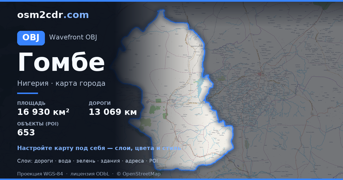
خريطة Gombe State بصيغة OBJ — تصدير بيانات OpenStreetMap الحقيقية للمنطقة المختارة.
Wavefront OBJ is a universal 3D model format with material support. Buildings are exported with texture coordinates and groups by type.
ما هي الطبقات الموجودة في الملف
يحتوي هذا الملف للمنطقة المختارة على:
- الطرق
- المباني
- المياه
- المساحات الخضراء
- نقاط الاهتمام
أنظمة الإحداثيات
WGS 84 (EPSG:4326)، قابل للاختيار في المعالج
التوافق
وحدات القياس
أمتار (مُسقطة في نظام الإحداثيات المختار)
| الفئة | 3D |
| امتداد الملف | .obj |
| المستوى | Free |
What's in the OBJ map of Gombe State
308,574 buildings (345 residential, 58 commercial, 3 industrial, 4 religious), 13,069.3 km of roads, 653 points of interest, 15 landmarks.
The area covers 16,930 km², with about 18 buildings per km².
Mostly unclassified roads 7,016.3 km, residential streets 3,749.6 km, tertiary roads 965.2 km.
1.5% of the area is green space.
The map marks 5 parks and 9 water bodies.
Key amenities: colleges — 18, schools — 75, libraries — 8.
Public transport: 3 bus stops, 4 rail stations.
3D scene with 308,574 buildings for Blender, Cinema 4D, and other 3D editors.
Main streets: Gombe - Potiskum Road, Mutum Daya to Filiya Road, Gombe - Biu Road, Gombe - Potiskum Road; Ashaka Bajago Road, TUMU KASHERE ROAD
Landmarks: Zoological park, Emir Palace Tangale, District Head Kalmai, WELCOME TO GOMBE CENTRAL GATE, Field 2
كيفية استخدام OBJ لـ Gombe State
- حدّد منطقة خريطة Gombe State في الصفحة الرئيسية
- اختر صيغة OBJ واضبط إعدادات التصدير
- اضغط على «تصدير» وانتظر اكتمال المعالجة
- نزّل الملف الجاهز واستخدمه في البرنامج المطلوب


